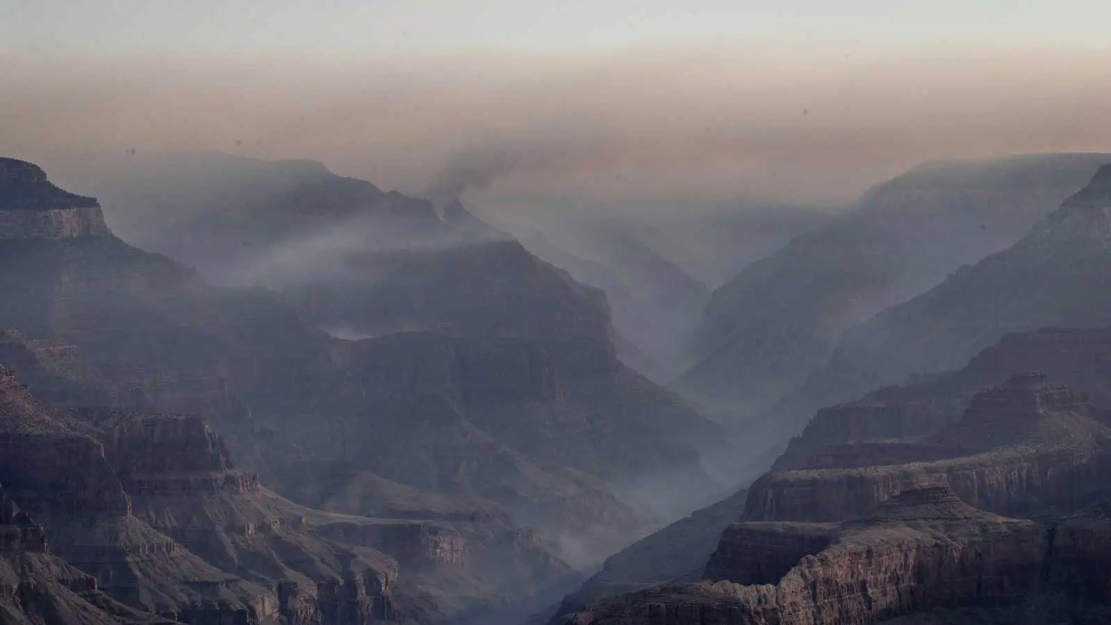
Where None Have Stood Before: A Return to the EAIIST Traverse

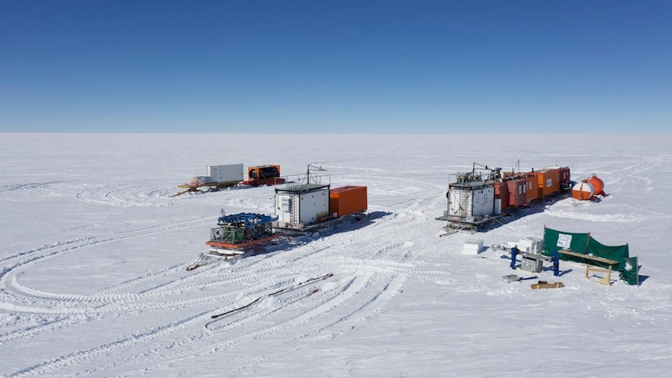
Above: The EAIIST traverse caravan seen from above by a research drone, on the East Antarctic Plateau more than 300 miles (450 kilometers) south of Concordia Station. All photos taken by Pete Akers unless otherwise noted.
Editor's note: Paleoclimate researcher Pete Akers (Institut des Géosciences de l’Environnement or IGE in Grenoble, France) is a participant in the 2019-20 East Antarctic International Ice Sheet Traverse (Project EAIIST). Pete is writing about the project in a special series for Category 6. See his Cat 6 contributor’s page for links to previous entries.
“Wait, EVERY step I take out here is the first time a human has stepped on this particular piece of ground.…”
This realization hit me suddenly on January 3, 2020, several hours after a Twin Otter plane flew me and fellow EAIIST member Nico Caillon (IGE, CNRS) 400 miles (650 kilometers) south from Concordia Station to rejoin the EAIIST caravan at the Megadunes site. And it was quickly followed by a second realization:
“And who knows the next time someone will step here, if it EVER happens again.…”
You can hopefully forgive the hours it took me to fully comprehend the nature of our existence while in the Megadunes region. The Megadunes site was the farthest point of the traverse, and at 80°S the caravan was closer to the South Pole than any scientific station other than the Amundsen-Scott Base at the pole itself (although some other small scientific camps closer may have also been temporarily inhabited at this time). And while other mid-20th century traverses, many flights, and even a couple scientific trips had already passed through the vast Megadunes region before, it was true that no one had ever been to the local region we were studying.
However, while scientifically and mentally fascinating to be somewhere no human has ever walked before, it admittedly lacks the immediate gratification of seeing the novel view from an unconquered peak or setting foot on an unknown island. The simplicity and ease of our travel to the Megadunes by plane also likely served to dampen any immediate realization for me. It took those few hours after my arrival for the excitement of catching up with colleagues and re-establishing my place in the caravan to subside so that I could actually stop and contemplate why this particular vast void of white ground and blue sky was different from the past two months of white and blue voids. I took this epiphany to wander a bit on my own over the nearby sastrugi and snow formations and tried to savor the moment before heading back to the caravan to check on instruments needed in the upcoming days.
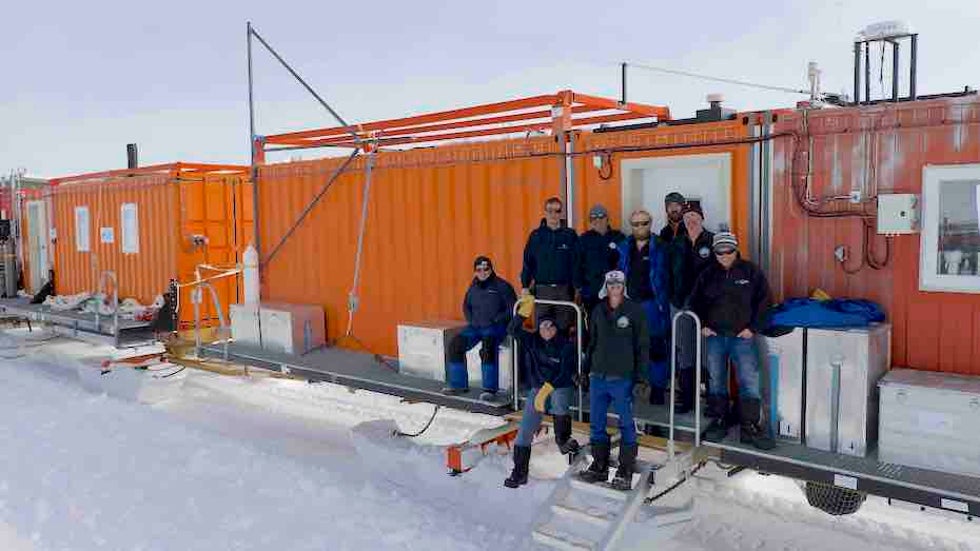
Prior to our arrival, EAIIST team members had completed a three-week journey by caravan from Concordia to the Megadunes, stopping several times along the way to install seismic stations, take samples from snow pits and ice cores, and study the snow physics and chemistry. A week before our return to the caravan, there had been an exchange of other EAIIST members by plane, with an expanded group of researchers studying and sampling within the Megadunes area. Nico’s and my arrival signified the start of the second leg of EAIIST, where the caravan would leave the Megadunes and head back to Concordia Station.
The Megadunes area is around 9500 ft (2900 m) above sea level and roughly 1000 ft (300 m) lower in elevation than Concordia. Being further inland, the Megadunes site is markedly drier than Concordia, which made it the prime target for the EAIIST project. The dry climate makes the area a possible analog to what Dome C’s environment would have been like in the colder and drier peak glacial periods (“ice ages”). Our work at the Megadunes will hopefully help us better interpret the EPICA Dome C ice core and many other future deep ice cores, like Beyond Epica-Oldest Ice.
As the Megadunes site is not at a locally high peak like Dome C, the gravity-powered katabatic winds are stronger here and pack the snow surface harder. Combined with the lower snowfall amount and low humidity, this gives the snowpack a glazed appearance and leads to many snow surface formations that are rare or absent elsewhere on the Antarctic Plateau. The megadunes themselves—parallel ridges of snow several mi (km) long and 1-2 mi (2-3 km) apart, but only ~15 ft (3 m) high—are one product of the unique local environment. However, the megadunes are so gently sloped that it is nearly impossible to see them from ground level. Instead, changes in the snow characteristics and small surface formations between the accumulating ridgetops and the eroding troughs are the main clues that something larger is present on the landscape. Those who took part in the earliest traverses through the region in the mid-20th century never even realized the megadunes existed.
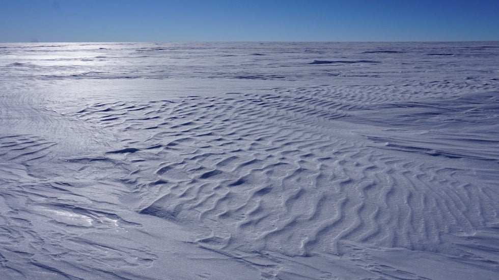
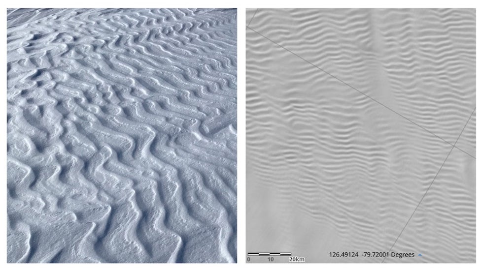
On the smaller scale, the snow surface at Megadunes is incredibly diverse in its structures. Most notable were patches of snow ripples, rarely seen in this number or size elsewhere we had traveled in Antarctica. Their prevalence here is likely due to the lower snowfall which means less loose snow is available to blow and drift. At snowier sites, blowing snow would accumulate faster and blur the ripples into more commonly seen wavy drifts, but here at Megadunes, there is only enough free snow to make the ripples.
In fact, these ripples look remarkedly like the megadunes themselves, only at a much smaller scale. This is not mere coincidence: the same environmental conditions needed to make the megadunes are also needed to make the ripples, and the main difference is simply the scale of the structure and creative forces.
Also common in the Megadunes area are thermal cracks in the snow surface. These cracks form as a result of the brutal cold and low humidity, which causes the surface snow to contract. Some of these cracks extend deep into the snow and allow the exchange and vertical transport of water vapor throughout the snow.
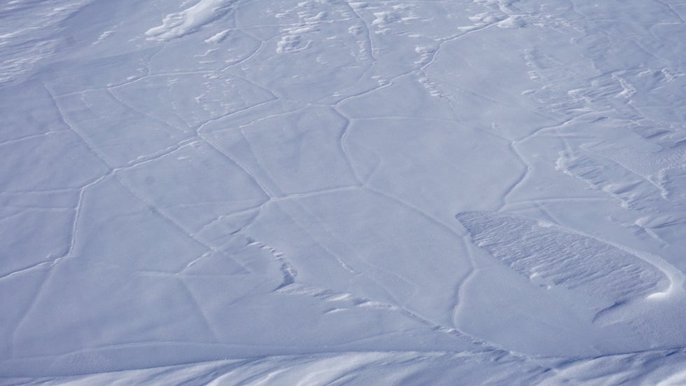
We dug a snow pit at one of these cracks and discovered that the movement of water vapor through the crack over many years had resulted in the growth of spectacular ice crystals. We collected samples of these crystals and will analyze them for water and aerosol isotopes in order to better learn about their history and their possible impacts on deep ice core interpretations.
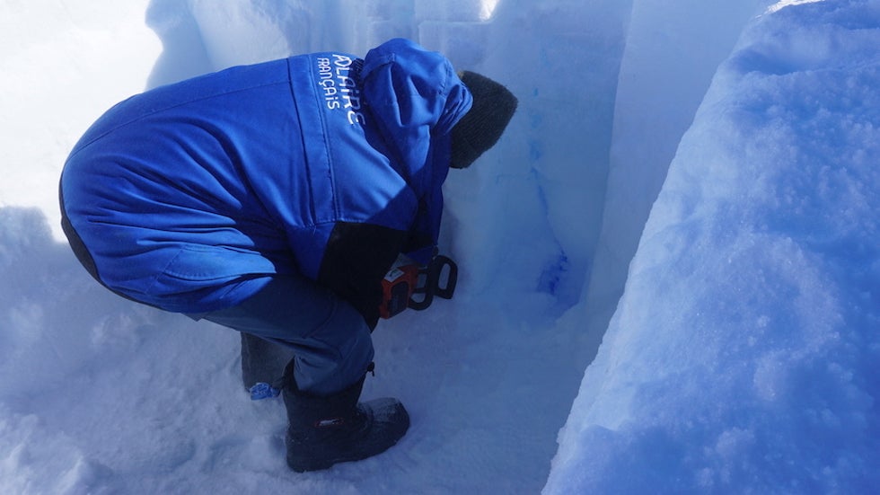
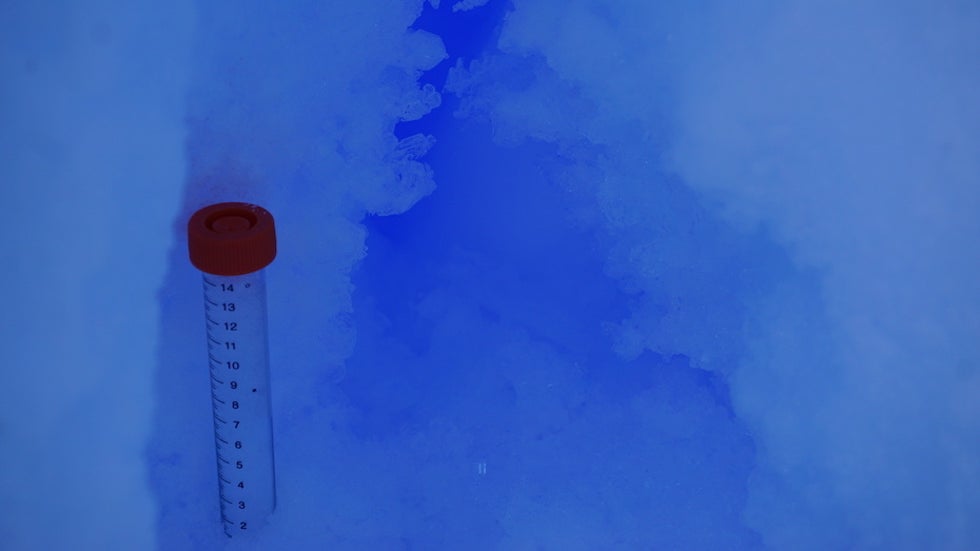
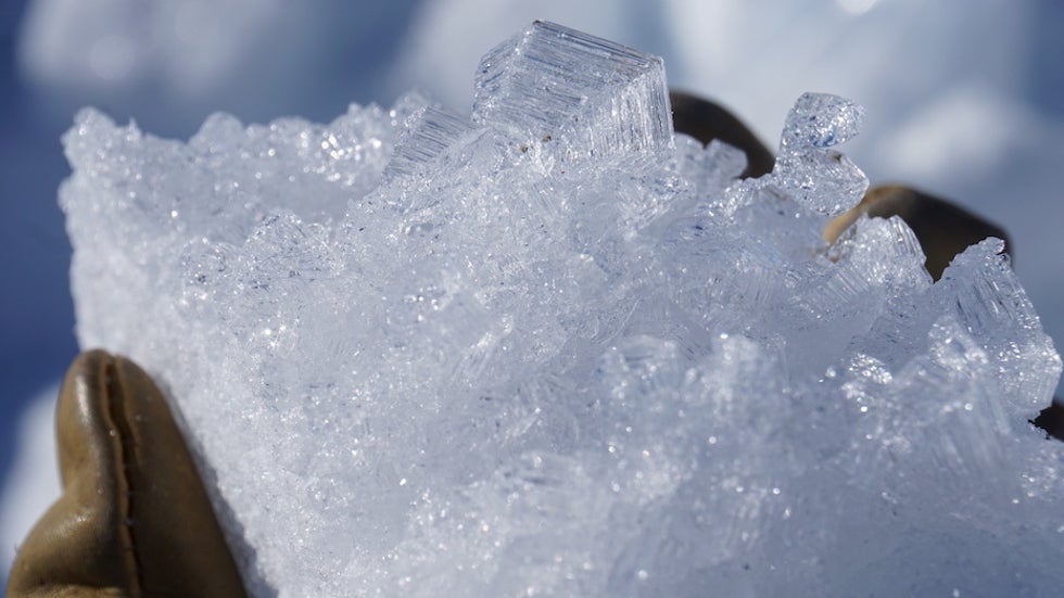
Prior to my arrival, members of the EAIIST team had already completing their sampling all over the local Megadunes area, including ridge tops, troughs, and places in between. A day after the plane dropped me and Nico off, the caravan was on the move again, headed back toward Concordia. After one and a half days of travel, we stopped at a site dubbed Paleo. On the first leg of EAIIST driving toward the Megadunes, the traverse had stopped near here to install a seismic station and construct a snow runway so that the seismic station could be retrieved by plane next year. We would stay at Paleo for over a week in order to drill an ice core and install a weather station.
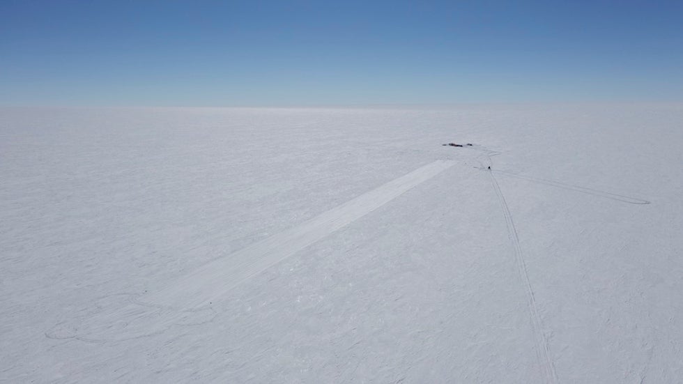
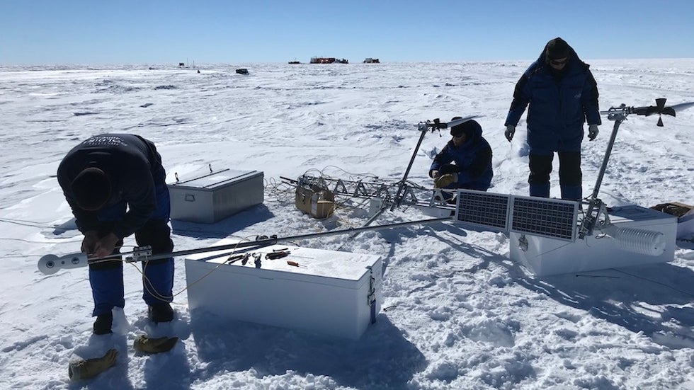
Our ice coring would eventually reach a depth of 580 ft (180 m), and my next post will focus specifically on the ice coring methods and results at Paleo. The other main scientific task at Paleo was for EAIIST member Vincent Favier to install an automated weather station. Assembly and installation took most of a day’s work, with calibrations and checks extending over the next days at Paleo. This weather station is equipped with sensors to measure air temperature, humidity, wind speed, and both incoming sunlight and outgoing heat and reflected light. The station is able to upload its readings to a satellite, and these real-time observations are valuable not only for research, but also for pilots who must cross over this part of Antarctica (which has very few weather stations).
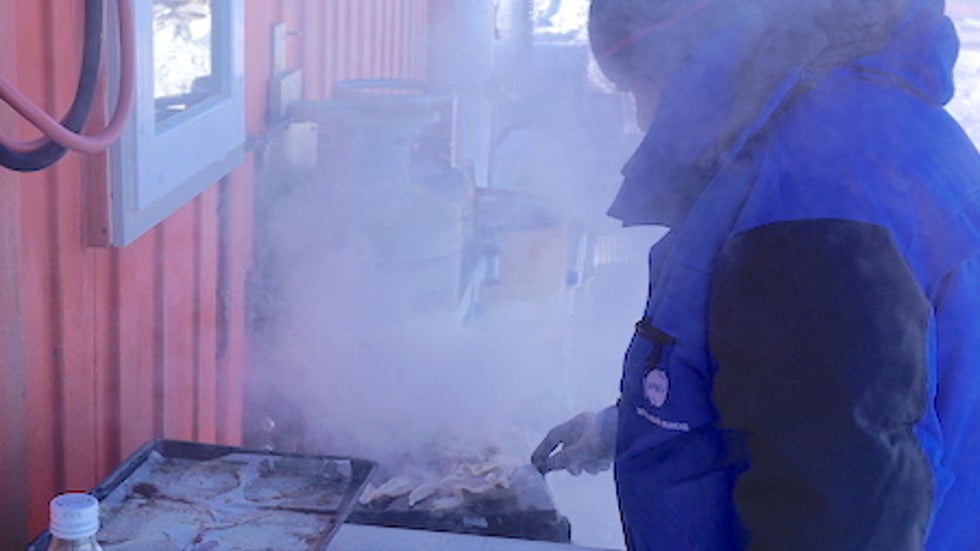
The EAIIST mission was running very smoothly at this point. Drilling of the main ice core at Paleo continued almost nonstop during working hours without major hiccup, and all other science goals were quickly completed. After only five days at Paleo, the full main core and some supplemental shallow cores had been completed. Travel time to return to Concordia was also expected to be shorter than originally scheduled, as the caravan was able to move mostly effortlessly over the snow. With the mission wrapping up ahead of schedule, the mood in camp was relaxed and joyous.
With the completion of the ice coring at Paleo, all major goals of the EAIIST mission had been completed. In all, the EAIIST mission had collected 2950 ft (900 m) of ice in 18 separate ice cores, installed three weather and six seismic stations, taken hundreds of individual samples for snow chemistry and physics, and completed a continuous monitoring of water vapor isotopes and airborne aerosols. All that remained was to make the final push back to Concordia and make sure that some seismic stations that had been installed on the first leg of EAIIST were working properly.
After two and a half days’ journey from Paleo, we arrived at our penultimate main stop of AGO5, named for an Automated Geophysical Observation post installed by American researchers in the early 2000s. Here, one of our last science tasks took place, as Vincent installed wooden stakes in the snow so that returning researchers could measure the new height of the stakes above the snow and calculate the accumulation rate.
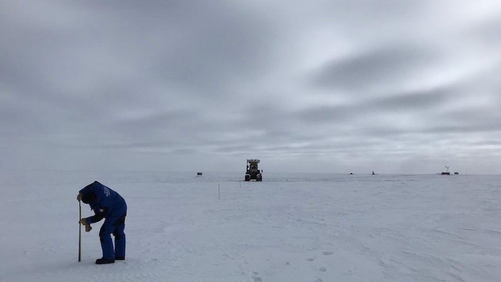
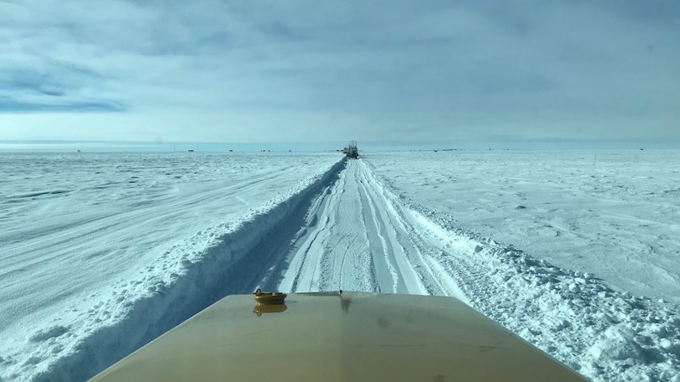
The weather during this travel turned from the typical sunny conditions to deeply overcast. With the thick cloud cover blocking direct sunlight, the contrast on the surface and between sky and ground disappeared. While you could still see objects like the caravan at a distance of a half mile (1 kilometer) or more, as it was not intensely snowing or windy enough for a ground blizzard, the overall view turned disorienting in the monotone whiteness. While driving, the lead tractors used bright headlights to illuminate the path ahead and create the contrast on the snow surface that the sun wasn’t providing.
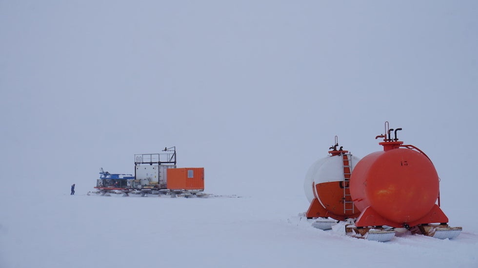
Travel to Concordia continued smoothly until we were only 38 miles (60 kilometers) from the station. At that time, a tractor broke a piston and then blew a hole in its engine block, rendering it dead and halting our caravan’s progress in the mid-afternoon. We have spare towing capabilities on EAIIST, so the loss of a single tractor was not a major problem. After loading the dead tractor onto a thick plastic sheet for towing, we also noticed that a major support strut under the warm lab had become unhitched at some point during the day’s travel and flipped 180° under the lab’s sled to point backward.
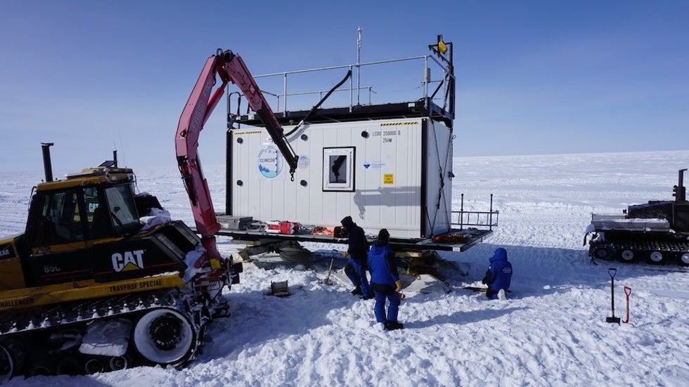
This was unrelated to the dead tractor, but required another lengthy half-day of maintenance to cut off the now-bent-and-destroyed strut and come up with a chain-based alternative that could get up to Concordia. Luckily, as we were over four days ahead of schedule, we still arrived at Concordia ahead of schedule and in good spirits.
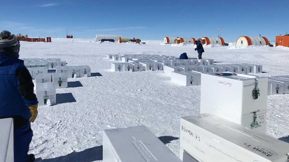
After a day’s rest at Concordia, work began again in earnest to prepare the caravan for its last journey back down to Cap Prud’homme and the coast. All 151 Styrofoam boxes containing ice core segments were unloaded, sorted by their analytical destination (some would go to Australia, others to Europe), tagged with shipping addresses, and repacked in a cooling container. At the coast, the cores would be loaded onto a French icebreaker and begin the journey to their destination, with French samples to arrive in Grenoble around June.
My next three days would be spent furiously melting snow pit samples and extracting anions from them in a similar manner as performed in the Dome C trench study. In the three days before the caravan departed for the coast, Nico and I were able to process 121 individual snow samples and load newly condensed samples with the ice cores for shipment to France.
As the caravan pulled out of Concordia Station on January 24, I was able to see them off and sigh in relief with a mission fully accomplished. For me, all that remained was a couple more days of sample processing and awaiting my flight off the continent at the end of the month.
The views of the author are his/her own and do not necessarily represent the position of The Weather Company or its parent, IBM.