Hurricanes, Typhoons & Cyclones
Ophelia Forms in Central Atlantic; Nate Leaves Dozens Dead in Central America

Above: A bridge is out as floodwaters rise in Provincia de Puntarenas, Costa Rica, on Thursday, October 5, 2017. Image credit: Instagram/@timeless_turmeric_dinalynn, used with permission.
Tropical Depression 17 has become the 15th named storm of this exceptionally active Atlantic hurricane season. As of 11 am EDT Monday, newborn Tropical Storm Ophelia had sustained winds of 40 mph, according to the NOAA/NWS National Hurricane Center. Ophelia is located in the remote Central Atlantic, about 860 miles west-southwest of the Azores, and weak steering currents will keep it safely in this area for the next several days.
Like many late-season systems, Ophelia developed from the lingering remains of a decaying front that pushed across the North Atlantic. Strong wind shear slowed down Ophelia’s organization, shunting its showers and thunderstorms (convection) mostly northeast of a distinct low-level center of circulation. Since Sunday, though, convection has gradually increased and persisted closer to Ophelia’s center, and some banding has developed on its east side.

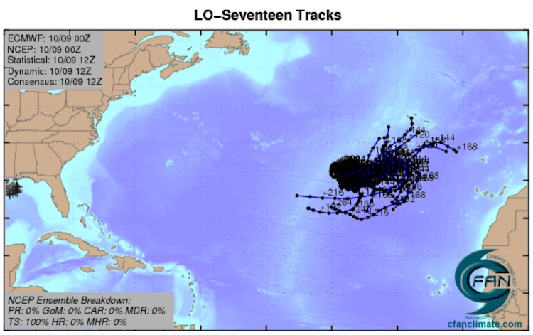
Ophelia is making the most of a lukewarm environment for classic tropical cyclone development. Sea surface temperatures (SSTs) are marginal, around 27°C (81°F, or about 2°F above average for this time of year), with negligible oceanic heat content, and the atmosphere is not especially moist (mid-level relative humidity around 55%). However, temperatures are unusually cold at upper levels, and this is boosting atmospheric instability, helping to compensate for the tepid SSTs. Moreover, Ophelia appears to be tucked into a location with less wind shear than the overall surrounding environment. The 12Z Monday run of the SHIPS model indicates that large-scale wind shear will decrease from its current 25 knots to around 15 knots by Wednesday, as a zone of upper-level westerlies shifts south of Ophelia. The 6Z Monday runs of two of our top intensity models, the HWRF and HMON, bring Ophelia to hurricane strength by Friday. Our top global track models, which are less reliable for intensity forecasts, are less keen on Ophelia: none of the 20 members of the GFS ensemble run from 0Z Monday, and only 3 of the 50 members of the European ensemble, bring Ophelia to hurricane strength. This seems a good time to go with the intensity-tailored models, and NHC is doing just that, predicting that Ophelia will become a hurricane by Friday. If so, it will be the Atlantic’s tenth consecutive tropical storm to become a hurricane, matching a record set in 1878, 1886, and 1893.
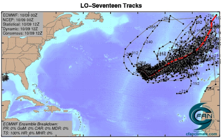
After a midweek relaxation of steering currents around Ophelia, a stronger midlatitude trough is expected to begin carting the storm east or northeast. The GFS and ECMWF operational runs from 0Z Monday suggest that Ophelia could threaten the Azores this weekend.
Watching for possible development east of the Bahamas later this week
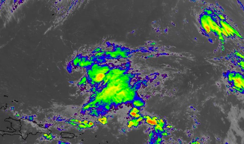
The same frontal zone that gave birth to Ophelia extends to the area north of the Leeward Islands, where a weak upper low is spawning scattered convection. There are model indications that a tropical cyclone could form in this area and move west-northwest toward the Bahamas later this week. A few ensemble members from both the GFS and Euro models develop this system into a tropical depression or tropical storm by midweek. This disturbance is not yet highlighted in NHC’s Tropical Weather Outlook, but we give it a 20% chance of development into at least a depression by Friday. Large-scale steering will bring the system toward Florida by the weekend. Even if it does not fully develop, this disturbance could dump several inches of rain on parts of Florida. The next name on the list of Atlantic storms is Philippe.
Picking up the pieces after Nate
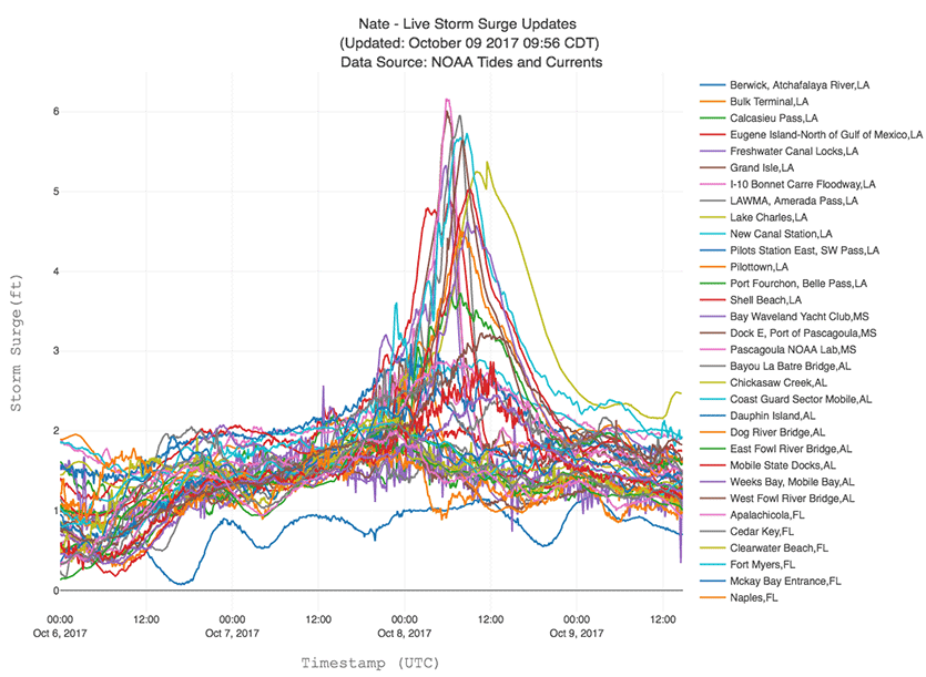
Now classified as a post-tropical cyclone in northwest Pennsylvania as of midday Monday, the remnants of former Hurricane Nate were bringing heavy rains to the Northeast U.S. after the storm made a double landfall on Friday night and Saturday morning as a Category 1 hurricane with 85 mph winds. Nate’s initial landfall occurred in Louisiana at the mouth of the Mississippi River on Friday night, with the second landfall coming a few hours later on the coast of Mississippi. Nate brought a peak storm surge of 6.3’ to Pascagoula, Mississippi, and storm surge flooding inundated much of the Alabama coast, including Dauphin Island. In Mobile Bay, Alabama, the Coast Guard Station recorded water levels of 5.5’ above high tide, and water levels reached 5.8’ above high tide at Bayou La Batre. In Louisiana, the highest water level was just over 4.5’ at Shell Beach.

#StormSurge coming inside entrance of Golden Nugget casino in Biloxi #HurricaneNate pic.twitter.com/Sv0wwIbjWu
— Mike Theiss (@MikeTheiss) October 8, 2017
According to the weather.com summary article on Nate, here are some peak wind gust reports in the U.S.:
- Calvert, Alabama: 75 mph
- Pascagoula, Mississippi: 70 mph
- Mobile, Alabama: 66 mph
- Destin, Florida: 58 mph
- Gulfport, Mississippi: 52 mph
As of midday Monday, the NOAA/NWS Storm Prediction Center had logged 21 preliminary tornado reports from Nate, including12 in South Carolina, 5 in North Carolina, and 2 in Alabama. Among some of the notable wind damage or power outages reports:
- Clay County, Alabama: Numerous trees down blocking roads, numerous power outages in northern and western parts of the county
- Highlands, North Carolina: Numerous power outages
- Tallapoosa, Georgia: One injured from a large tree downed on a building
Here are some selected high rainfall totals from Nate:
- 11.62 inches in Great Falls, North Carolina
- 11.17 inches in Bear Creek, North Carolina
- 10.48 inches in Hogback, North Carolina
- 9.37 inches in Highlands, North Carolina
- 8.32 inches in Crestview, Florida
- 6.99 inches in Milton, Florida
- 6.95 inches in Slidell, Louisiana
- 6.94 inches in Dixon, Alabama
- 6.54 inches in Foley, Alabama
- 6.12 inches near Greenville, Kentucky
- 5.48 inches at Anna Ruby Falls, Georgia

Nate’s toll in Central America
Hurricane Nate may not have left enough U.S. damage for the United States to request retirement of Nate’s name from the list of Atlantic storms. However, Nate’s impact on Central America, where 30 deaths are being blamed on the storm, 15 of them in Nicaragua, could well lead to its retirement. Costa Rica President Luis Guillermo Solís on Saturday called Nate’s aftermath the greatest crisis in the country’s history, after flooding from 12 hours of torrential rain on Wednesday killed 11, left 11,000 homeless, severely damaged the nation’s road system, and knocked out water to 447,000 people—about 9% of the nation’s population. “The magnitude of the damage caused by Tropical Storm Nate in the entire road infrastructure of the country is of titanic proportions,” said German Valverde, describing the condition of the national road network. The embedded tweet below includes this comment from Solís (as translated by Bing): “Protect yourself and protect your family! We do our work of care and protection for citizens and communities.”
¡Protéjase y proteja a su familia! Nosotros hacemos nuestro trabajo de atención y protección a ciudadanía y comunidades (Fotos: Filadelfia) pic.twitter.com/EUO8MoDvHs
— Luis Guillermo Solís (@luisguillermosr) October 5, 2017
Costa Rica hurricane history
Government officials said the damage from Nate is comparable to that of Hurricane Otto of 2016, the only hurricane on record ever to pass over Costa Rica. Otto killed 10 people and did $190 million in damage to the country. According to EM-DAT, the international disaster database, the deadliest and most destructive tropical cyclone in Costa Rica’s history was Hurricane Cesar, which made landfall in Nicaragua just north of Costa Rica on July 28, 1996, as a Category 1 storm with 75 mph winds. Cesar crossed over Central America and later became Category 4 Hurricane Douglas in the Eastern Pacific. Cesar/Douglas’s heavy rains caused flooding that killed 51 and did $200 million (1996 dollars) in damage to Costa Rica.
All-time warmest October lows in D.C. area on Sunday
Nate’s trek north helped reinforce a very warm, moist air mass in place east of the Appalachians. Summerlike dew points in the 70s led to unusually muggy conditions for early October. The low temperature on Sunday at Washington’s Reagan National Airport was 75°F. In records dating back to 1874, that was the city’s warmest daily minimum ever recorded in October, breaking the 74°F record set on October 4 and 5, 1898, and October 4, 1941. Capital Weather Gang reported that the mid-70s dew points were virtually unprecedented for this late in the autumn. All-time warm daily lows for October were also set at Washington’s Dulles Airport (73°F) and Philadelphia (74°F). Conditions in D.C. on Sunday were so oppressive that the annual Army Ten-Miler Road Race was cut short and recast as a “recreational run,” according to Stars and Stripes.
We’ll be back later today with an update on major fires that erupted north of the San Francisco Bay area on Sunday night. Critical fire weather conditions were shifting into the Los Angeles area on Monday, with strong Santa Ana winds expected.
Jeff Masters co-wrote this post.
The Weather Company’s primary journalistic mission is to report on breaking weather news, the environment and the importance of science to our lives. This story does not necessarily represent the position of our parent company, IBM.